


Estudiar la Tierra no es una hazaña fácil.
El análisis espacial, una característica común de los sistemas de información geográfica (SIG), nos ayuda a quienes estudiamos el mundo que nos rodea a entender nuestro entorno y los impactos que generamos en él de manera más sencilla.
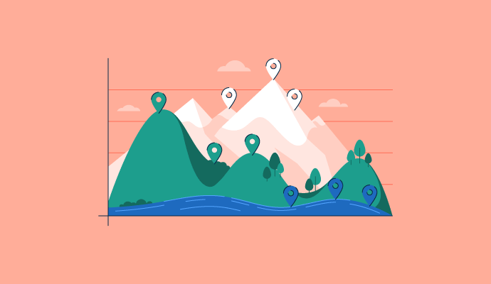
Los análisis espaciales se realizan a través de software SIG que captura, analiza y muestra datos espaciales para crear un mapa 2D o 3D de diferentes ubicaciones en relación con puntos específicos.
¿Qué es el análisis espacial?
El análisis espacial, o estadísticas espaciales, determina la relación entre variables utilizando sus propiedades topológicas, geométricas o geográficas. El proceso ayuda a extraer nueva información sobre conjuntos definidos de coordenadas para realizar exámenes, evaluaciones y análisis rutinarios de diferentes ubicaciones.
Los datos espaciales son las ubicaciones geográficas de varias características físicas en la Tierra, como lagos, montañas y ríos. Esta información se registra típicamente en coordenadas en un mapa.
Los diversos tipos de datos geográficos a menudo se colocan en un mapa digital en capas, llamado mapeo SIG. Las personas que realizan análisis espaciales pueden estudiar el mapa capa por capa para recopilar información específica. El procesamiento por computadora ayuda a los usuarios a determinar la idoneidad geográfica, predecir patrones y comprender el cambio climático.
6 tipos comunes de análisis espacial
Dependiendo del contexto y la aplicación del análisis que se esté realizando, hay seis tipos de análisis espacial para establecer correlaciones entre objetos, eventos y lugares refiriendo sus ubicaciones a posiciones geográficas.
- Autocorrelación espacial se refiere a estadísticas que miden y analizan el grado de dependencia de dos coordenadas en una ubicación geográfica.
- Interpolación espacial estima las variables en ubicaciones no observadas en comparación con los valores en ubicaciones observadas.
- Regresión espacial captura la dependencia espacial y ayuda al análisis estadístico previniendo problemas como parámetros inestables y pruebas poco fiables.
- Interacción espacial estudia el flujo de personas, materiales o información entre ubicaciones en un espacio geográfico dado.
- Geoestadísticas de múltiples puntos analiza las estadísticas espaciales de un modelo geológico y genera realizaciones de las estadísticas de puntos de entrada.
- Geocodificación utiliza coordenadas o describe una ubicación y la convierte en una ubicación específica en la superficie de la Tierra.
¿Quieres aprender más sobre Software GIS? Explora los productos de SIG.
Casos de uso del análisis espacial
Dado que el proceso va más allá del mapeo y facilita la resolución de problemas orientados a la ubicación, el análisis espacial permite un estudio significativo entre lugares geográficos y las relaciones formadas dentro y fuera de ellos.
Desde ofrecer una comprensión del crecimiento de las ciudades hasta asignar puntajes de riesgo en lugares de desastres ambientales, varios casos de uso geoespacial benefician la toma de decisiones para las partes interesadas en diferentes industrias.
Planificación urbana
Los planificadores urbanos desarrollan procedimientos y programas para cómo se puede usar la tierra. Mapean comunidades, planifican el crecimiento y construyen instalaciones y ciudades inteligentes. Los planificadores urbanos realizan análisis espaciales para rastrear cambios ambientales y tener en cuenta cómo podrían impactar a la comunidad.
Ciencia ambiental y geografía
La responsabilidad de un científico ambiental es evaluar la salud de una ubicación geográfica. Estas personas a menudo trabajan en el campo realizando diversas pruebas en la tierra. Los científicos ambientales dependen del análisis espacial para capturar datos que les ayuden a predecir el cambio climático y monitorear estrategias de gestión energética.
Aplicación de la ley
Los profesionales de la aplicación de la ley utilizan el análisis espacial para rastrear puntos críticos de criminalidad. Los analistas de delitos utilizan ciertos datos de estos análisis, como los datos demográficos del censo, para comprender mejor por qué ocurren delitos en ciertas áreas. Estos datos también ayudan a las agencias a despachar más eficazmente a los oficiales de policía durante una emergencia.
Salud pública
Los trabajadores de salud pública se centran en mejorar la salud de los residentes en su comunidad. Estas personas estudian la calidad de los alimentos y el agua y rastrean la contaminación del aire y la prevención de enfermedades. El análisis espacial utilizado junto con el análisis de atención médica les ayuda a rastrear riesgos ambientales, como una fuente de agua contaminada.
5 mejores software SIG para análisis espacial
La tecnología SIG ayuda a los usuarios a comprender patrones en la geografía y mejorar las operaciones en ubicaciones específicas. Los productos de software a veces incluyen capacidades de visualización, para que los usuarios puedan ver sus datos como un mapa antes de que se publique.
Para ser incluido como una solución de software dentro de esta categoría, un producto debe:
- Editar, analizar y almacenar datos geográficos
- Incluir capacidades de visualización
- Tener características SIG para manipular datos de mapas
* A continuación se presentan las 5 principales soluciones de software SIG líderes del Informe Grid® de Invierno 2023 de G2. Algunas reseñas pueden estar editadas para mayor claridad.
1. Esri ArcGIS
Esri Arc GIS es una suite completa de herramientas de mapeo e inteligencia de ubicación. Proporciona una colección de capacidades de datos y contenido para enriquecer geográficamente los datos empresariales y crear productos de mapeo únicos.
Lo que más les gusta a los usuarios:
“ArcGIS es un software poderoso que se puede usar para analizar datos basados en la ubicación. ArcGIS comprende varias características como ArcMap, ArcCatalog, ArcGIS Pro, ArcScene y ArcGlobe. La caja de herramientas de Arc tiene varias herramientas, incluyendo análisis espacial, estadísticas espaciales, geocodificación, gestión de datos, conversión, herramientas de cartografía, etc.
- Reseña de Esri ArcGIS, Chanchala D
Lo que no les gusta a los usuarios:
“El software tiene problemas al manejar una gran cantidad de datos y generalmente se bloquea (al menos la versión que uso). Así que prefiero hacer el procesamiento de grandes volúmenes de datos en otros entornos.
Me gustaría tener más métodos estadísticos introducidos en ArcGis, creo que podrían ser útiles.”
- Reseña de Esri ArcGIS, Alina R.
2. Google Earth Pro
Google Earth Pro es un programa de computadora que representa en 3D la Tierra mapeando ubicaciones a través de imágenes superpuestas por satélite, fotografía aérea y datos SIG. Permite a los usuarios visualizar ciudades y paisajes desde diferentes ángulos.
Lo que más les gusta a los usuarios:
“En general, Google Earth Pro es un gran caballo de batalla: requiere una cantidad significativa de poder de procesamiento, aunque es bastante extraordinario en términos de la calidad de las imágenes producidas, la capacidad de retroceder décadas en el tiempo casi en cualquier lugar del mundo, cambiar el día/hora para las condiciones de iluminación, medir distancias, etc.
También es increíble que sea gratuito, lo cual es enorme para estudiantes, jóvenes profesionales, etc."
- Reseña de Google Earth Pro, E.J R.
Lo que no les gusta a los usuarios:
“Aunque la mayoría de los lugares tienen datos actualizados, algunas áreas tienen imágenes desactualizadas e información ligeramente desactualizada. Esto puede ser un problema de privacidad o tal vez leyes de información, pero algunos datos son algo irrelevantes. Esto ocurre en ciudades pequeñas y necesita mejora.”
- Reseña de Google Earth Pro, Harshit S.
3. BatchGeo
BatchGeo hace que crear mapas usando datos tabulares sea simple al optimizar datos geográficos en formatos simples. La plataforma ofrece una variedad de opciones de visualización de datos que van desde códigos de color y grupos hasta mapas de calor con capacidades de fácil compartición con mapas protegidos por contraseña.
Lo que más les gusta a los usuarios:
“¡BatchGeo es increíblemente fácil de usar! Me gusta lo simple que es importar una hoja de cálculo de nombres y direcciones y lo rápido que se genera un mapa después de eso. Se siente intuitivo de usar, y la velocidad a la que se generan los mapas agrega positivamente a mi experiencia general.”
- Reseña de BatchGeo, Derrek S.
Lo que no les gusta a los usuarios:
“Faltan algunas características de informes para analizar más a fondo las direcciones geocodificadas por lotes. Me gustaría ver que esta funcionalidad se expanda para profundizar más en la comprensión de nuestra información.”
- Reseña de BatchGeo, Drew N.
4. Google Maps API
Google Maps API es una plataforma de mapeo que incluye direcciones de conducción, imágenes de Street View, entre otros. Crea experiencias del mundo real en tiempo real con características de la plataforma de Google Maps.
Lo que más les gusta a los usuarios:
“Google map API es una parte inteligente de la tecnología de Google. Con la ayuda de esto, puedes configurar Google Maps directamente en nuestro sitio web. Es una gran experiencia para los visitantes. Sus lenguajes de programación son JavaScript, Ruby, Python y Java. Las API, o interfaces de programas de aplicación, son esenciales para las organizaciones en todos los negocios.
La importancia de las API desde un punto de vista especializado es que permiten que las capacidades de un programa de computadora sean utilizadas por otro. Son un método por el cual dos programas distintos pueden comunicarse.”
- Reseña de Google Maps API, Faisal M.
Lo que no les gusta a los usuarios:
Lo más importante en lo que creo que Google debería trabajar es en su función SnapToRoad en la API. Google Maps API no traza con precisión los datos de snap-to-road cuando le damos las cadenas de Latitud y Longitud en el objeto de solicitud. Hace giros en U no deseados, círculos debido a los cuales la trazado es inexacto.
Google Maps API no funciona bien si la precisión de las latitudes y longitudes está por encima de 100. Aquí las API de mapas funcionan mejor al eliminar tales coordenadas"
- Reseña de Google Maps API, Chirag P.
5. ArcGIS Online
ArcGIS Online es una solución de software SaaS escalable y segura alojada por Esri. Utiliza mapas interactivos para conectar personas, ubicaciones y datos. La solución permite la creación rápida de mapas utilizando estilos de Mapeo Inteligente para mejorar las visualizaciones de datos.
Lo que más les gusta a los usuarios:
“Es simple de usar y tiene excelentes plantillas. Se integra bien con la versión de escritorio de ArcGIS. Me encanta que los clientes puedan interactuar fácilmente con los paneles y ver su información.”
- Reseña de ArcGIS Online, Kyle Y.
Lo que no les gusta a los usuarios:
“ArcGIS Online no es tan poderoso como ArcGIS Pro. Tampoco es bueno actualizando rápidamente sus capas. Por ejemplo: si importo datos y realizo un análisis sobre ellos pero quiero cambiar una entrada, necesito eliminar la capa, hacer el cambio en Excel, importar los nuevos datos y volver a realizar el análisis. Tampoco me gusta cómo no puedo cambiar el estilo de las capas preestablecidas de Living Atlas.”
- Reseña de ArcGIS Online, Usuario en Salud
No más ¿Dónde está Wally?
El análisis espacial es crítico para crear y explicar modelos geográficos para problemas específicos de ubicación. Dado que el proceso utiliza procesamiento por computadora, simplifica la exploración y el examen de resultados para estudiar el impacto en lugares y comunidades.
¿Quieres saber más sobre cómo se visualizan y rastrean los activos en el contexto empresarial? Aprende más sobre el seguimiento del sistema de posicionamiento global (GPS) - una actividad organizacional esencial para mantener una gestión de la cadena de suministro sin problemas.
Este artículo fue publicado originalmente en 2019. Ha sido actualizado con nueva información.

Brynne Ramella
Brynne is the Buyer Inquiry Team Lead at G2 Crowd. In addition to writing, she leads the research specialists in providing personalized software and services recommendations to buyers. She wishes she had interesting hobbies to include in this bio.

